

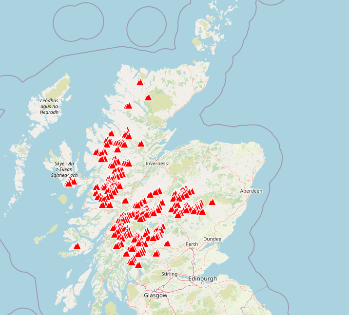
Munros are defined as Scottish mountains over 3,000 feet (914.4 m) in height, and named after Sir Hugo T. Munro who published a list in 1891. The Scottish Mountaineering Club officially lists 282, most of which are clustered around the north-central Scotland mainland. There are a dozen on the Isle of Skye and one on Mull. Some are fairly inaccessible, requiring a long walk in and out and a few require a guide. My brother has spent around 20 years climbing most them and perhaps he only realised a few years ago that it was feasible to finish them all.
This weekend the family joined him to witness and celebrate climbing his last Munro, Sgurr Choinnich Mor.
The group agreed to stay in the Clan Macduff hotel in Fort William for the weekend, from which it’s not too far to drive up the Glen Nevis valley (beyond the path up to Ben Nevis itself) and walk up from there.
Planning Ahead
So the question was how best to get from southern England to Fort William for a short weekend trip:
- 9 hours drive (plus stops) each way
- 12 hours by train
- 2 airborne hours in my TB20 aircraft
Not really difficult to choose. If the weather was too bad to fly, then we probably wouldn’t be climbing any mountains.
The next question was which airport to fly into. There is a remarkably convenient airstrip at Glendoe, just north of Fort William, which I have flown past. However this is a quite a short grass strip and I would think fairly susceptible to bad weather at times. The closest options would be Inverness to the north, Oban to the south west, or Glasgow/Cumbernauld/Perth to the south.
A hire car would make the trip much more convenient, although a bus or taxi for the last leg could also be considered. A quick look at car hire prices in both Inverness and Glasgow was quite a shock – £600 for 2 days for even the most basic vehicle. I believe this was because so many have been taking holidays in the UK but car hire companies haven’t been able to restock with new cars, hence a shortage. Prices do seem to have come down a lot since.
Further research found a local car hire available from Oban airport for £120 with free cancellation so I took that. Oban airport isn’t IFR, but we thought that if the weather was that bad then mountain climbing would be out too.
Nearer the day, after checking the weather, I arranged PPR via the Oban Airport website which was promptly accepted. Having visited earlier this year, I have to say they are easy and friendly to do business with and the airport is well run with fuel now available at a fairly reasonable price.
Autorouter has been my primary IFR routing tool for some years. Initially it came up with a number of options involving flight over the Irish Sea and the Isle of Man. I found one that was almost direct and filed that at FL90.
EGBJ N0144F090 STAFA P18 LISTO DCT MCT DCT CALDA DCT SUBUK DCT RIPNO DCT TRN EGEO

Gloucester to Oban
Gloucester can be very busy around 10am, particularly just before the second controller comes on duty and the tower/approach frequencies are split. So we aimed to depart at 9:30 having arrived at 9 for the pre-flight checks, and had filed for that time.
It often takes a bit longer than you hope to get ready, and today manoeuvring the aircraft out of the hangar took some time. We were off blocks at 09:43, just as the airport changed runways to 04 (which very much suited our departure direction). I had thought that IFR flight plans were allowed a tolerance of +/- 15 minutes, so just within limits.
The delay in receiving our IFR clearance seemed to be due to a bottleneck with London Control not being able to issue them promptly, and we heard a commercial flight school aircraft ahead of us also being delayed with their airways clearance to Cardiff. The Gloucester controller asked us if we would be happy to depart VFR on a Basic Service which we accepted, and that got us airborne at 09:57 local. We squawked 2000 to indicate that as far as I was concerned I was flying IFR, although we had not yet been accepted into the airways system and would remain outside controlled airspace until further clearance.
After landing, I found an email from Autorouter which advised that because my aircraft had not been seen airborne by 09:45, then the flight plan had been cancelled. This does seem to imply that the +/-15 minute tolerance I had thought applied to off-blocks time actually relates to airborne time, effectively giving me less than 5 minutes after EOBT to get going.
Gloucester Approach don’t have radar (although I suspect they have something to assist them) and asked for an altitude check a couple of times before I reached FL70. They have to separate other IFR traffic based on pilot position (and altitude) reports, and were waiting for me to pass FL50 before clearing another IFR aircraft to climb or descend in the same area.
Above FL50 I was passed on the Western Radar, a unit based at NATS Swanwick Control Centre, who issued a squawk, provided a Traffic Service above FL70 and cleared me into controlled airspace at FL90 towards TELBA. There are a couple of controlled airspace issues here which I should have remembered from my previous flight north.


It was a special family event long in the planning. My older brother has been a keen Scottish hillwalker for years and wanted to celebrate climbing his last Munro.
SkyDemon warns you about Cotswold CTA which is Class C above FL75 and doesn’t provide any further detail. My actual climb performance on the day was better than plan and I did enter it.
A subsequent reference to the AIP Part 2 En-Route Section 6 identifies this segment as Cotswold CTA 18, with a reference to note 16 shown below.
Flexible use of airspace.
Class C between hours 1700-0900 (1600-0800) Monday-Thursday
and 1700 (1600) Friday (or the day preceding a PH) to 0900 (0800) Monday (or the day
following a PH).
Outside the published hours of service the airspace reverts to Class G.
Bottom line is that this is active evenings/nights (5pm through 9am local time) Mon-Thurs but active ALL WEEKEND. So my flight on Friday was OK, but Saturday or Sunday would have infringed airspace.
This may be fairly easy to work out in the comfort of my armchair but quite a bit more of a struggle to do that when flying the aircraft single pilot. Fortunately the controller was able to answer my query and confirm it was cold.
However the BHAM CTA7 airspace on my right hand side controlled by Birmingham was a different case, and the controller was keen that I remained west of that. This is why they prefer aircraft departing north from Gloucester to route direct to TELBA rather than STAFA. My autorouter flight plan proposed and validated use of STAFA, so there appears to be a systemic failure of the rules given to Eurocontrol computer to validate. These presumably originate from NATS Standard Route Document, which lists preferred rather than mandatory routes. It’s a monster spreadsheet with over 35,000 lines and over 500 notes, so it won’t be a quick fix.

Western Radar issued a further squawk code to me, which I believe was related to my full airways entry clearance, and passed me onto Scottish Control at FL90. Once in controlled airspace, a more direct routing to POL was later followed up with a “maintain current heading” and subsequently a Direct-To POL. Effectively the switch to current heading does nothing to your current track (assuming no change in wind or speed), but allows the controller to reduce separation from other aircraft because you are now under positive radar vectoring. He warned me I might see an airliner passing 1,000 feet below, but we didn’t spot anything close by. When switching back from heading mode to navigation mode on the KAP140 autopilot, I find that it has to recalibrate wind drift correction from scratch. This can result in a minute or so of heading slightly the wrong way before it gradually senses and corrects for the error. I don’t know if this is a surprise to controllers who might expect a smoother transition to a precisely calculated ground track.


It’s much hard to determine by looking at the chart alone.
Around Settle, I was informed that I would be leaving controlled airspace in a couple of miles, service terminated and told to contact London Information. They were expecting me and didn’t require any further information, so although they can’t provide any radar service they did co-ordinate my subsequent handover to Scottish Control. Further clearances were given to RIVEL and ABEVI during this time, although again these wouldn’t have originated from London Information who can’t directly issue them, only relay them.
At FL90 I was just below the airways until reaching Lockerbie, where Scottish approved my request for a direct-to Oban at FL90. This was a very straightforward routing above the clouds, with the occasional view of the hills and towns below. Just before leaving controlled airspace north west of Glasgow, I asked for and was quickly granted a slight diversion for weather to avoid some towering cumulus that was quickly expanding ahead of us..


Once past Glasgow, with Loch Lomond on our right hand side, it was time to plan for the descent. At this altitude, you need to be thinking about that some 30-40 miles away. The mountains in this area are not as high as they are further north, so it is quite reasonable to descend down to 4,000 feet. Scottish were able to provide a traffic service until about 5,000 feet after which I switched to Oban Information. They provided airport information and asked to me to report at five miles.
I flew towards Oban town with a view to being over the water if I had to descend further without sight of the ground, but we were well clear of the cloudbase and had a good view of what is actually quite a compact hillside town and harbour. I took my time to make a gentle wide downwind join and right base for runway 19 – there was no other known traffic in the area.


After refuelling, we parked up, ate our own snack lunch in the terminal, collected our hire car in the town, walked around a bit and had a coffee before driving up to Fort William. It took less than an hour driving through some lovely and dramatic scenery.
Fort William
The mountain to be climbed was reached by first driving up Glenn Nevis valley, right to the end beyond where Googlemaps thinks the road ends (despite listing the car park). Then a few miles of mostly level walk up to the Steall Falls. It’s part of the Ring of Steall, a series of Munros but not the target for today.
We did walk most of the level section, but left the climbers to reach the mountain top in four hours.
I had taken a picture of Glenn Nevis during my previous flight to Scotland in August.


Instead we visited the Glenfinnan Viaduct, famous from the Harry Potter movies, and on which the daily Jacobite steam trains operate providing the full experience. There was quite a crowd to watch the trains pass over.


My brother can now call himself a “Compleator”, as those who have climbed all the Munros are known. The Scottish Mountaineering Club have recorded over 7,300 to date, with my brother saying he met someone who was on his fourth time round.

We also came across a group of Morgan owners enjoying driving in the area and who stayed at our hotel.
Straightforward return leg to Gloucester
The weather was again favourable for our return journey. My reverse routing seemed easier to plan and pretty much a direct route. In fact the routing filed was simply
CLYDE DCS MCT (Glasgow, Dean Cross, Manchester).
I requested start from the FISO at Oban but didn’t make it clear we had filed an IFR flight plan, so had to clarify that when ready for departure. This meant that Scottish had relatively little warning that I was airborne but Scottish Information quickly activated the plan and passed me on to their colleagues in Scottish Control who issued my clearance before reaching controlled airspace.

As before, I re-entered controlled airspace around the Settle area, ontrack towards SETEL followed by direct to MCT and then direct to Gloucester. I managed my own descent profile after leaving controlled airspace and had hoped for a direct right-base join, but other traffic piped up before me and I had to fly the full standard overhead join, widening out my circuit to fit in with the slower joining traffic.
Favourable winds meant it took just two hours airborne time from Oban to Gloucester.
Another relatively uneventful, enjoyable airways trip which sure beat the very long drive both ways.
PIC Time this weekend: 4:40
Total PIC to date: 1863:15
Total time to date: 2074:25